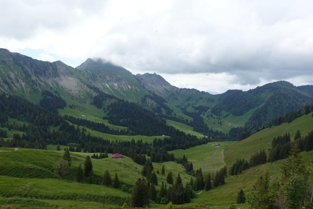
Round trip through the green meadows of the Fribourg Alps with beautiful panoramic views.
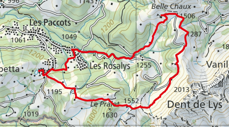
- Starting point: Les Paccots “Les Joncs”
- End point: Les Paccots “Les Joncs”
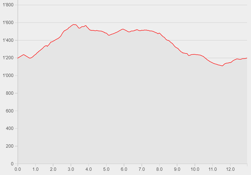
- Length: 13 km
- Duration: 4h10
- Ascending altitude: 719m
- Descending altitude: 719m
Start your hike at Les Joncs (go up to the Lac des Joncs if you like). Follow the yellow signs towards Col de Lys (or path number 266). The path starts ascending through the forest continues and across green meadows. You will reach an intersection where you have to follow the signs to Belle Chaux via Saletta. Cross more cow paddocks and pass by the mountain restaurants Saletta, Belle Chaux and Vuipay. From Vuipay, the path descends down to Les Rosalys. Follow the last part through the forest until you reach Les Joncs.
Hint: Buy some good cheese in the mountain huts (for example Le Vuipay).