Not enough time in Zermatt to do all the hikes you want to? Combine the classics – blue mountain lakes, impressive glaciers, Gornergrat and of course, the Matterhorn, Matterhorn, Matterhorn!
- Starting point: Zermatt
- End point: Zermatt
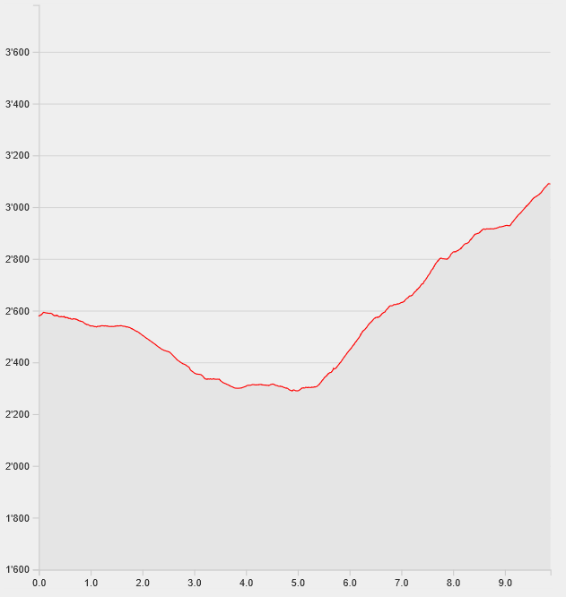
- Length: 9.9km
- Duration: 3.45h
- Ascending altitude: 883m
- Descending altitude: 883m
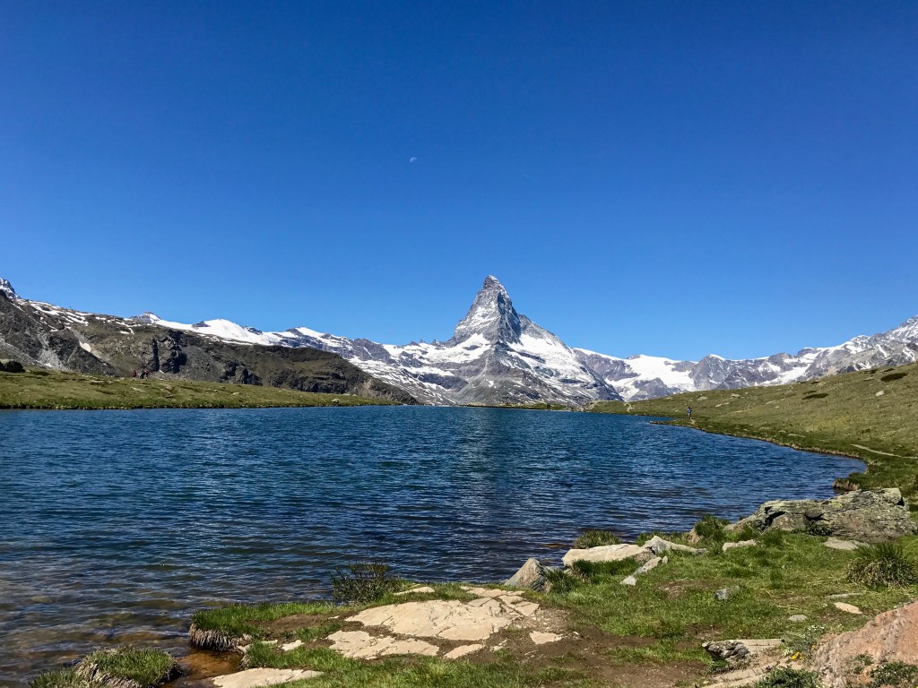
Take the cable car to Blauherd and follow the signs to Stellisee. Take a picture of the Matterhorn’s reflection in the lake. Your next stops will be Grindjisee, followed by Grünsee. From the restaurant close to Grünsee, a small path called “Weg der Stille” will lead you up to the Gornergrat. This second part of the hike is less frequented and more challenging since you will tackle 800m in altitude. Enjoy the view from the Gornergrat onto the highest peak of Switzerland, the Dufourspitze, as well as numerous glaciers and of course the Matterhorn. From there, go back to Zermatt by train.
Do you want more Matterhorn? Then walk down from the Gornergrat to the Ryffelsee and take the train from Ryffelalp to Zermatt.