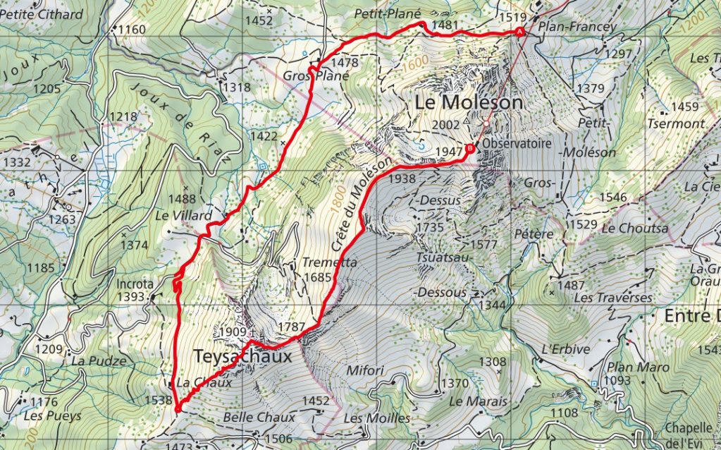
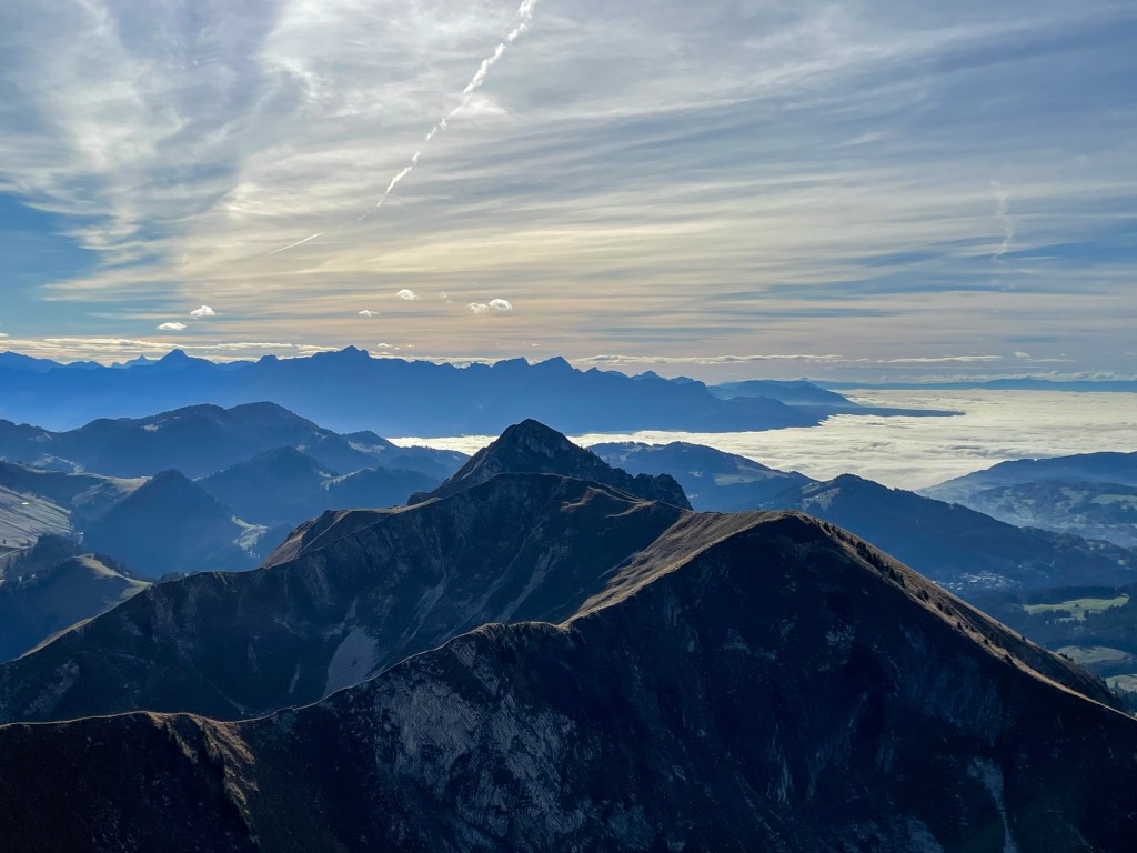
On this round trip you will hike along the ridge between Moléson and Teysachaux with views of the Pre-Alps of Fribourg.
Starting point: Plan Francey
End point: Moléson
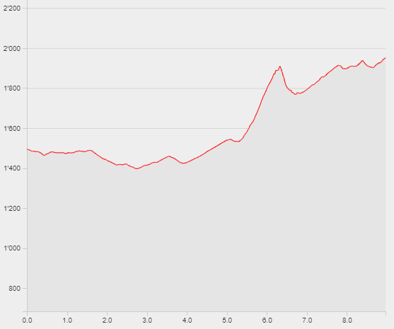
Length: 9km
Duration: 3h30
Ascending altitude: 872m
Descending altitude: 416m
Start the hike at the middle station Plan-Francey. Follow the signs towars Grand Plané and continue towards La Chaux at the foot of Teysachaux. Now a very steep zig zag ascent starts until you reach the rocky part and the summit of the Teysachaux. Enjoy the views of the green Pre-Alps of Fribourg. Continue the hike with a steep descent to reach the ridge of Moléson. Enjoy the hike along the ridge until you reach Moléson. Take the cable car back down to Plan-Francey.