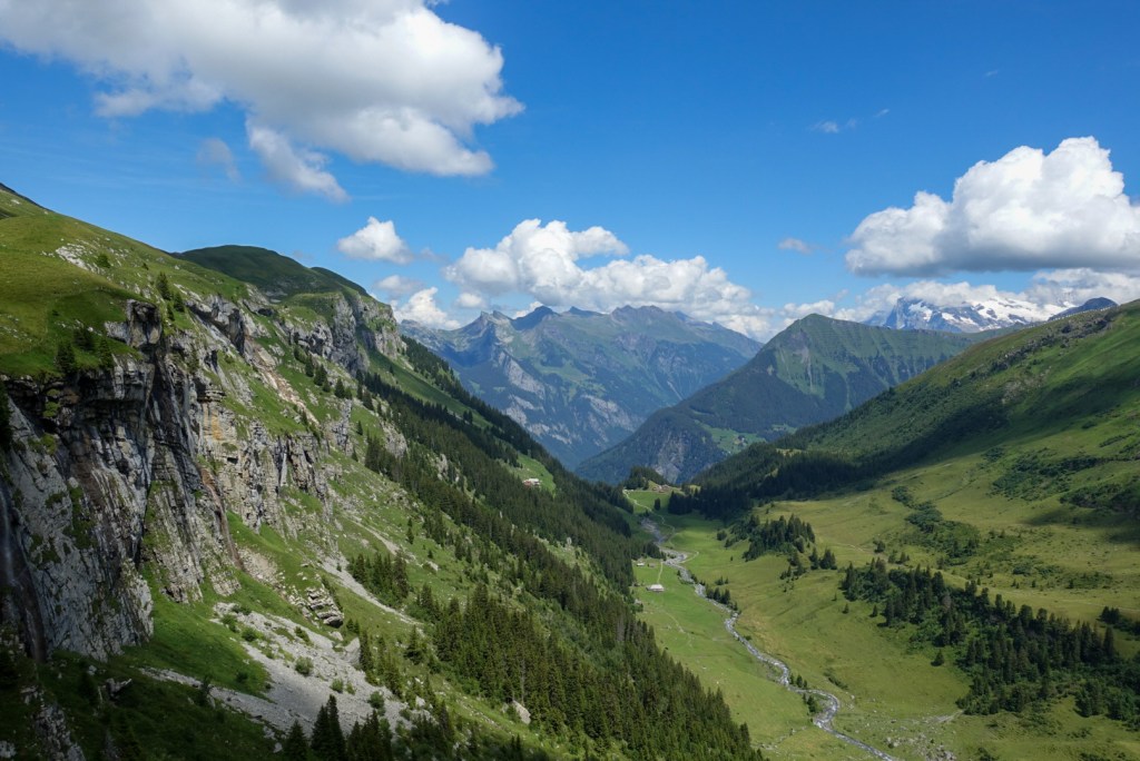
One-way hike through a landscape full of steep cliffs, waterfalls and plenty of mountain streams.
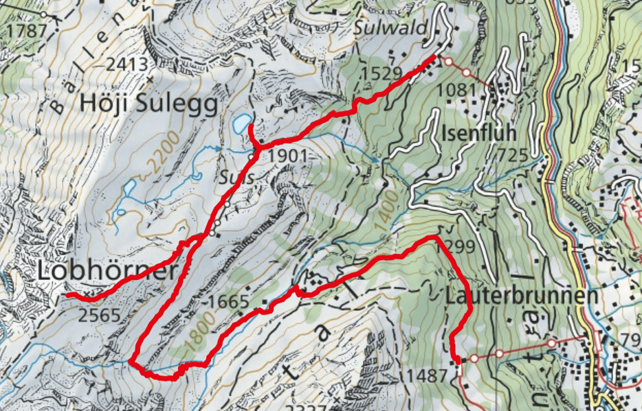
- Starting point: Isenfluh
- End point: Lauterbrunnen
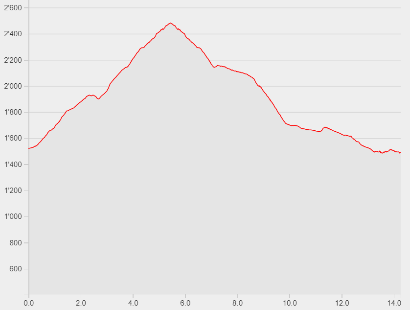
- Length: 14.3km
- Duration: 6h
- Ascending altitude: 1180m
- Descending altitude: 1210m
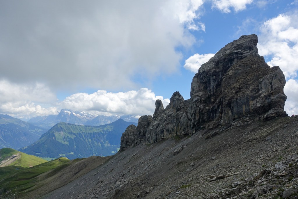
Start your hike in Isenfluh, where you take the small cable car to Sulwald. Walk up through the forest until you reach the mountain huts of Suls. Take a little detour of 10min to enjoy a break at the Sulssee. Go back and pass the mountain huts in direction of Lobhörner. In the middle of this ascent there is a crossing where you need to follow the signs to Schwalmere. This path will lead you up to the feet of the iconic Lobhörner. Take the same way back to the crossing and then follow the signs down to Grütschalp. The first part of this path runs across fairly flat green meadows with views of steep cliffs and waterfalls in the distance. A steep zig-zag path will then lead you down to a green highland section. The last part of the hike goes through the forest until you reach the Grütschalp cable car station to go down to Lauterbrunnen.