Challenging round trip with rewarding views in to the valleys, glaciers and Verbier.
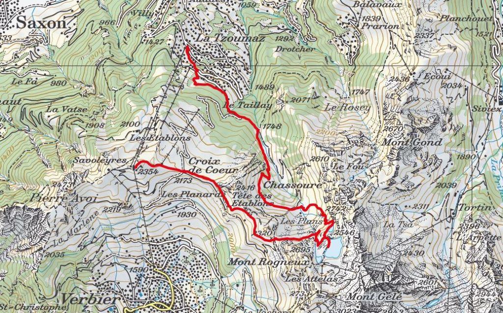
- Starting point: La Tzoumaz
- End point: La Tzoumaz
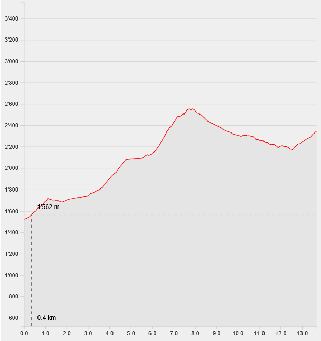
- Length: 13.7km
- Duration: 5h
- Ascending altitude: 1337m
- Descending altitude: 521m
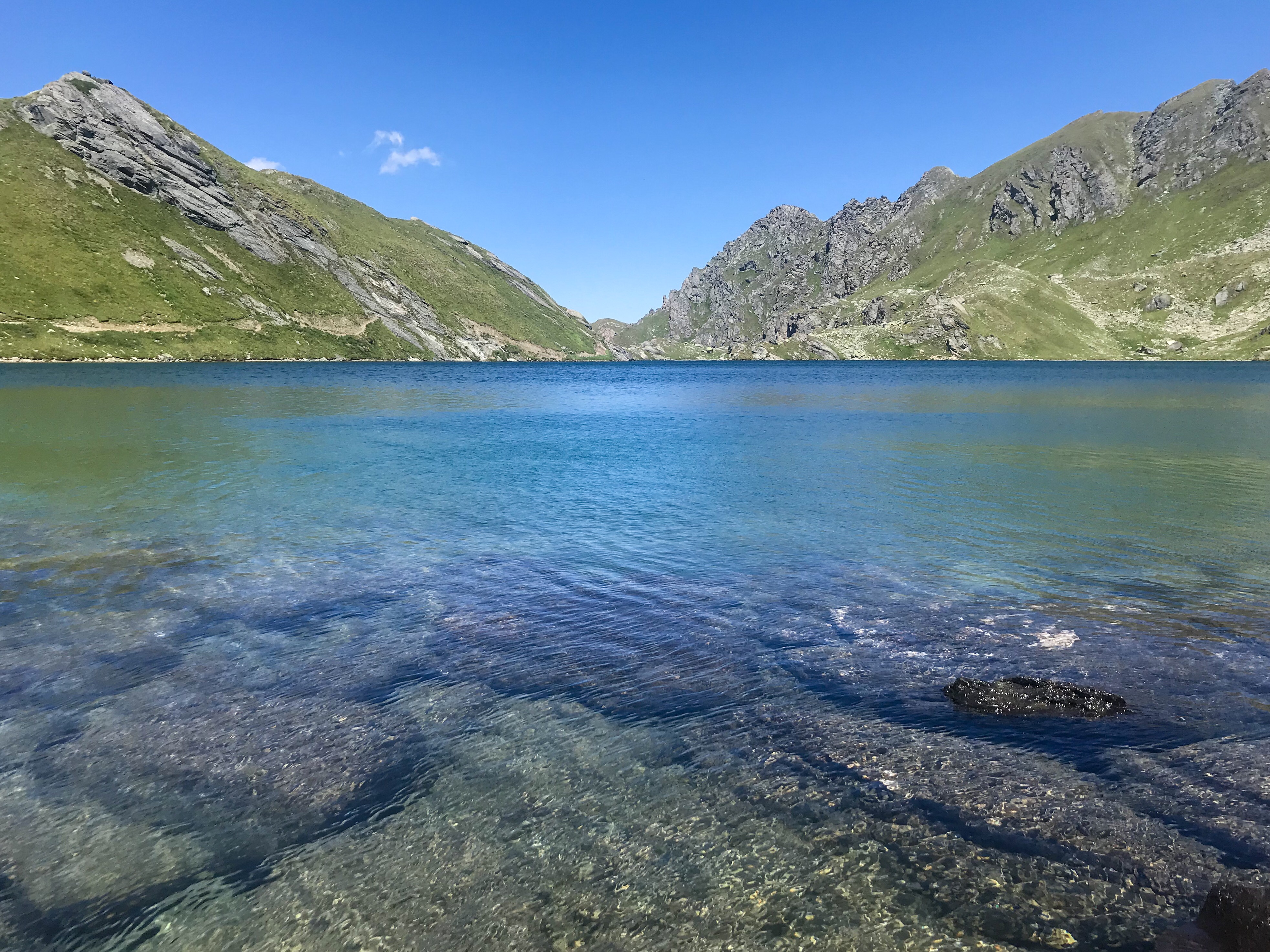
Your path starts at the cablecar station Savoleyres in La Tzoumaz. Follow the signs “Lac des Vaux”. After a steep climb through the chalets of La Tzoumaz, you will arrive at “La maison de la Forêt”. Enjoy the level path through the forest, following the yellow hiking signs. From “Les Pontets”, follow the gravel road which climbs up to “Les Plans”. Here you have the opportunity to rest your legs on the green meadows before you start you steep zig zag climb to the mountain lake. From here, just follow the red white hiking marks to Lac des Vaux, where you can enjoy a swim in the crystal clear water. Recommence the descent in the direction of Col des Mines and follow the small path on the mountainside with a view on Verbier, the Grand Combin and the Glacier de Corbassière. From La Croix de Coeur, a last steep climb will lead you to the cablecar station Sevoleyres which will bring you back down to La Tzoumaz.
Hint: You can do this hike the other way around (Savoleyres – La Croix de Coeur – Col de Mines – Lac des Vaux – La Tzoumaz)