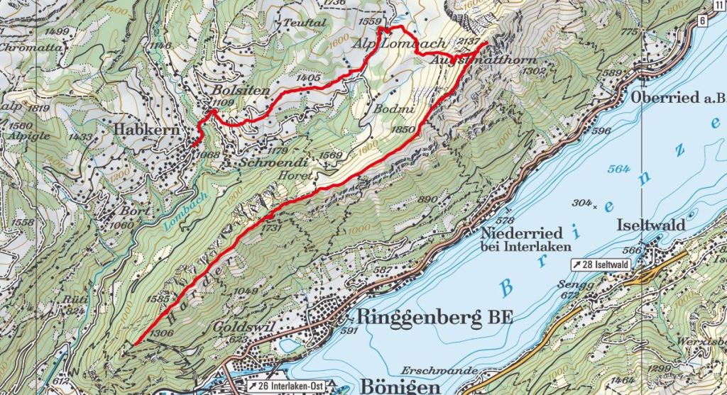
One-way crest hike above the Brienzersee with a spectacular view on Eiger, Mönch & Jungfrau.
- Starting point: Habkern
- End point: Harder Kulm
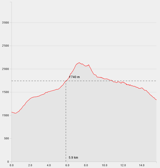
- Length: 15.6km
- Duration: 6h30
- Ascending altitude: 1351m
- Descending altitude: 1086m
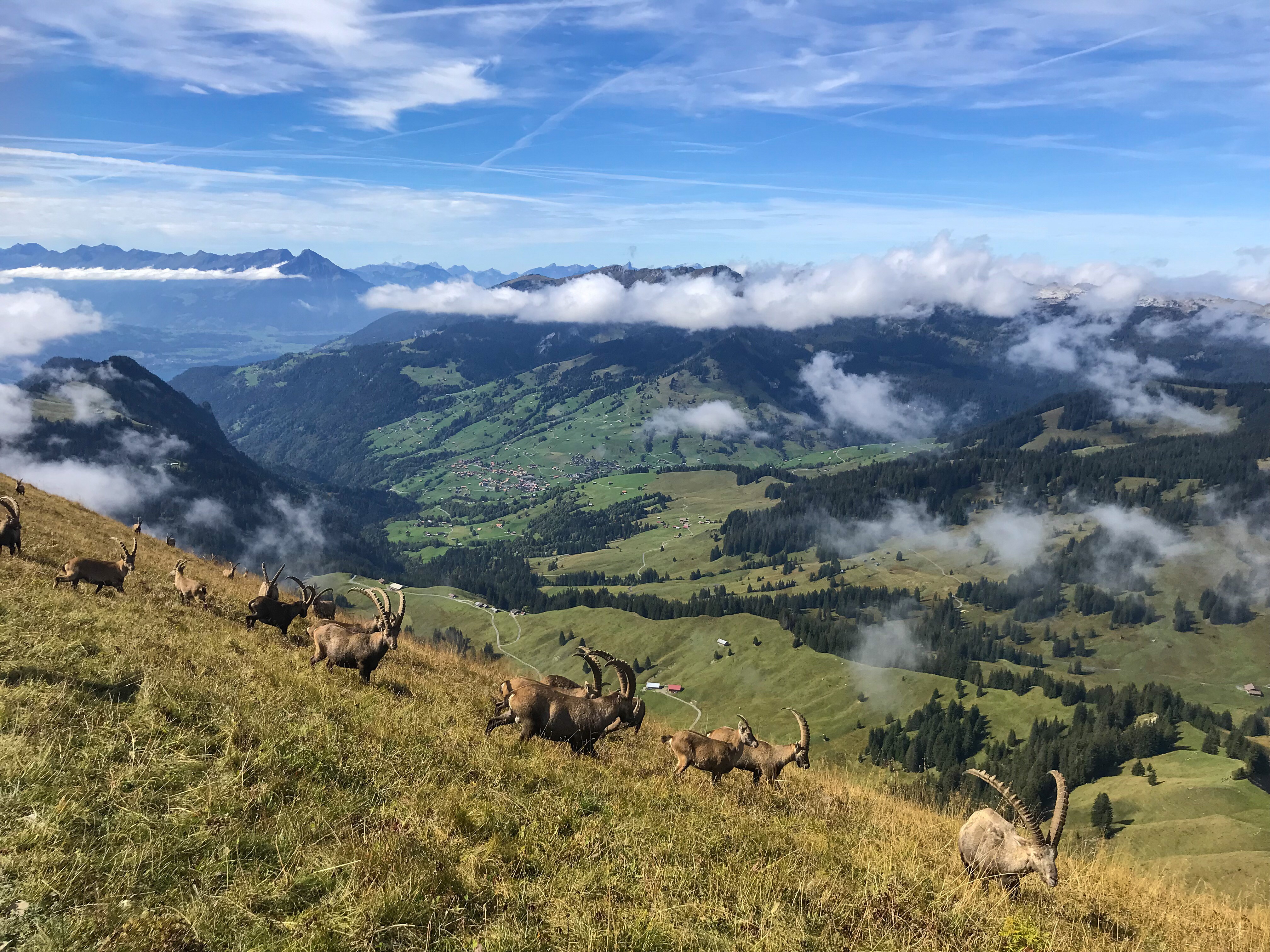
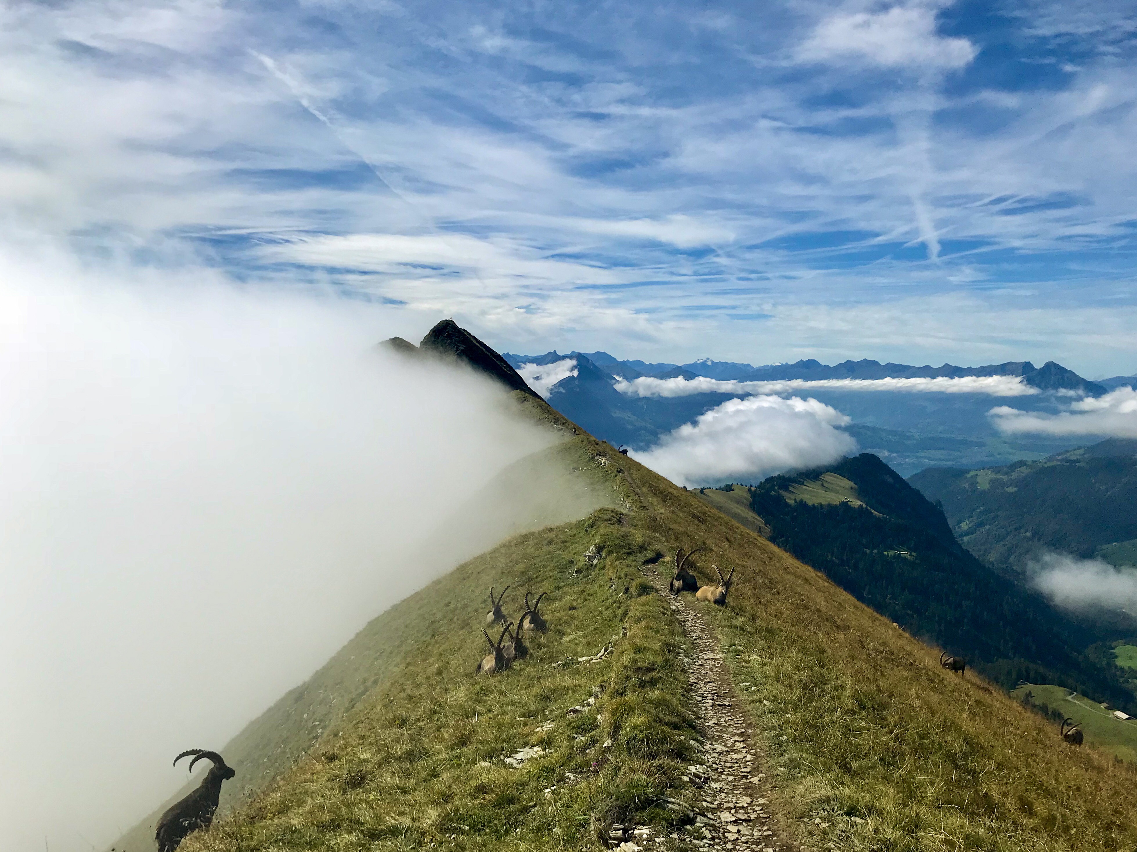
Start your hike in Habkern and walk in the direction of Lombach Alp. After you arrive at the restaurant Lombach Alp, pass through the marshes and onto a steep track that takes you up to the crest. On the top of the crest, follow the sign to Augstmatthorn. Congrats! You have completed the hardest part of the hike! You can now enjoy the amazing 360° view from up there. Always keep your eyes open and with a bit of luck you will spot some capricorns. From now on, follow the slightly declining crest path via Suggiture until you reach Harder Kulm. Take the cablecar down to Interlaken.
Hint 1: You can transform this hike into a round trip. To do so follow the path on the crest to Suggiture and further on until you reach the sign to Habkern.
Hint 2: Start your hike directly at Lombach Alp by taking a private taxi from Habkern to Lombach Alp. This will save up approximately 2h of hiking time and 500m of altitude.